Drone Photogrammetry in Architecture and Construction: From Site Reality Capture to Scan-to-BIM Design
Drone photogrammetry transforms overlapping aerial images into measurable site data, including orthomosaics, point clouds, terrain models, and CAD or BIM references. This guide explains the workflow, applications, accuracy limits, and ways drone capture complements professional surveying.
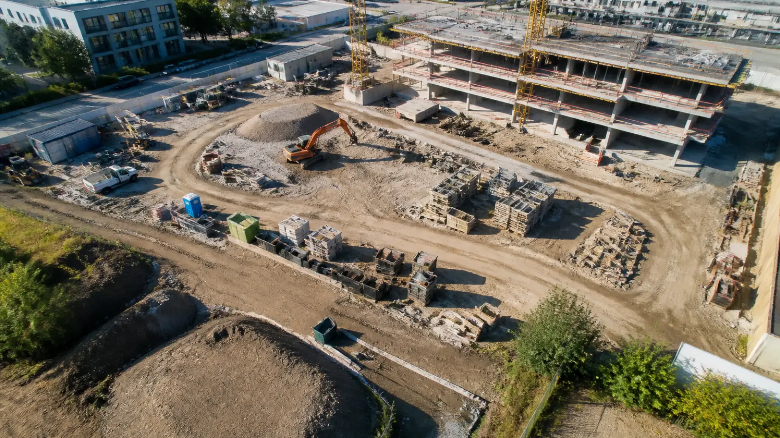
The drone revolution in design and construction is not only about capturing impressive aerial images. Its more valuable contribution is turning existing site conditions into measurable digital information before architectural and engineering decisions are finalized. With a carefully planned flight, overlapping photographs can become orthomosaics, point clouds, terrain models, and coordinated references for design and BIM teams. A drone mapping and reality capture platform can help organize this process, but reliable results still depend on survey planning, control, processing, and professional judgment.
For architects, developers, civil engineers, and contractors, the central question is simple: how closely does the digital model represent the real site? The answer affects grading, access, drainage, building placement, utility coordination, quantities, and constructability. Drone photogrammetry in construction provides a practical way to improve that understanding, particularly during feasibility, concept design, and preconstruction.
Why Reality Capture Matters Before Design Begins
Early design often begins with a mixture of title plans, old drawings, photographs, GIS information, and assumptions made during a short site visit. Those sources can be useful, but they may not show recent earthwork, undocumented structures, vegetation, stockpiles, surface damage, access restrictions, or changes in adjacent properties. A current aerial survey gives the project team a common visual and spatial reference.
That reference can improve decisions in several ways. The design team can assess how a proposed building sits within its surroundings, the civil engineer can study visible drainage patterns and grades, and the contractor can identify staging constraints before pricing is finalized. Developers can also communicate site conditions to stakeholders without requiring every participant to visit the property.
Photogrammetry does not make design decisions automatically. Instead, it reduces uncertainty by supplying a more complete record of what is visible and measurable. It is most valuable when the information is captured early enough to influence the design rather than merely document a decision that has already been made.
What Drone Photogrammetry Produces
Georeferenced aerial imagery and orthomosaics
A standard aerial photograph contains perspective distortion. An orthomosaic corrects much of that distortion and combines multiple images into a single, map-like image. When the project is properly georeferenced, the orthomosaic can be viewed against a coordinate system and used to examine site boundaries, roads, roofs, hardscape, vegetation, drainage features, and construction progress.
For design teams, an orthomosaic is often the most accessible output. It can be imported into mapping, CAD, or coordination software as a current visual base. It does not show hidden conditions, but it provides a useful overview for tracing visible features and comparing the site with existing plans.
Point clouds, meshes, and digital surface models
Photogrammetry software identifies common features across overlapping photographs and uses them to calculate three-dimensional positions. The resulting point cloud is a collection of points representing visible surfaces. A mesh connects those points into a textured three-dimensional surface that can be easier to visualize.
A digital surface model, or DSM, represents the elevations of visible surfaces, including roofs, vehicles, vegetation, and other objects. These outputs can support visual coordination, surface measurements, and context modeling. However, they should not be confused with a record of buried utilities or concealed building elements.
Digital terrain models and contours
A digital terrain model, or DTM, attempts to represent the bare ground by filtering out objects such as buildings and vegetation. From this surface, teams can generate contours, slope maps, profiles, and preliminary cut-and-fill calculations. The quality of the DTM depends heavily on ground visibility and the processing method. Dense vegetation, standing water, loose materials, and steep shadows can make terrain extraction less reliable.
The Drone Photogrammetry Workflow for Architecture and Construction
Define the design question and survey area
The first step is not selecting a drone. It is defining what the data must answer. A concept design may require a broad site and context model, while a grading review may require tighter control over ground elevations. A façade study, roof assessment, or renovation project may need oblique imagery and higher image resolution in selected areas.
The team should identify the site boundary, required deliverables, coordinate system, expected accuracy, areas that need detail, and how the files will be used. This prevents the common mistake of collecting attractive imagery that cannot support the intended CAD or BIM workflow.
Plan the flight and establish control
Flight planning considers altitude, image overlap, camera angle, sun position, wind, obstacles, airspace, privacy, and safe operating procedures. Nadir images point primarily downward and are useful for mapping. Oblique images capture façades, retaining walls, and vertical features but require additional planning.
Ground control points are marked locations with accurately known coordinates. Checkpoints are independent locations used to test the final model. Together, they help connect the imagery to the project coordinate system and provide evidence of positional quality. Real-time kinematic or post-processed kinematic drone systems can reduce reliance on numerous ground control points, but they do not eliminate the need for validation.
Capture, process, and validate the data
After the flight, photographs are checked for blur, exposure problems, gaps, and insufficient overlap. Processing software aligns the images, generates a camera solution, builds the point cloud, and produces the requested surfaces or maps. The output should then be reviewed against control and checkpoints.
Quality control should document the coordinate reference system, ground sampling distance, control layout, processing settings, observed errors, exclusions, and known limitations. A file without this information may look precise while giving downstream users no basis for judging whether it is suitable for design.
From Aerial Capture to Scan-to-BIM
Scan-to-BIM is the process of using reality-capture data as a reference for creating or updating a building information model. In a conventional scan-to-BIM workflow, terrestrial laser scanning is often used for detailed interiors and façades. Drone photogrammetry can complement that data by covering roofs, large sites, earthworks, surrounding buildings, and areas that are difficult or unsafe to access from the ground.
The aerial point cloud may be cleaned, classified, cropped, and transformed into a format supported by the project’s coordination environment. It can then be linked or referenced while modelers develop site elements, existing structures, terrain, or context geometry. An orthomosaic can support site plans, while a terrain model can inform civil surfaces and preliminary grading.
The key is to distinguish raw or semi-processed reality data from modeled design information. A point cloud is not automatically a BIM model. Modeling requires interpretation, agreed levels of detail, naming conventions, coordinate alignment, and decisions about which elements are sufficiently reliable to represent. Teams should also retain the source data and metadata so later users can understand how the model was produced.
Design and Preconstruction Applications
Site planning and feasibility
Drone mapping can give architects and developers a current view of building setbacks, neighboring structures, access routes, visible easements, slopes, and site obstructions. When combined with boundary and survey information, it helps teams test massing options and identify conflicts before detailed design begins.
Existing-condition documentation
For renovation, adaptive reuse, and phased development, aerial capture can document roofs, yards, courtyards, external plant, façades, and relationships between existing structures. It is particularly useful when drawings are incomplete or when a site has changed since the last documented survey.
Grading, drainage, and civil coordination
Terrain models and contours can support early grading studies, surface-water analysis, road alignment reviews, and coordination between architectural and civil models. The data can reveal apparent low points, embankments, retaining features, and changes in grade that may affect accessible routes or foundation strategies. It should not be treated as a substitute for drainage design, geotechnical investigation, or underground utility locating.
Context modeling and visualization
Three-dimensional site and context models can improve stakeholder communication. Planning teams can view a proposed building against current surroundings, while clients can understand site constraints without interpreting technical drawings. This is more than presentation value: better context can expose overlooking, shadow, access, and constructability issues earlier.
Quantity checks and constructability review
Where the surface is suitable and the accuracy is known, point clouds and terrain models can support preliminary area, volume, and stockpile checks. Contractors can also review laydown areas, crane access, haul routes, and temporary works constraints. These outputs should be clearly labeled as preliminary when they are not based on a survey-grade deliverable or final field verification.
Accuracy, Limitations, and Professional Surveying
Drone photogrammetry accuracy depends on camera quality, flight height, image overlap, lighting, surface texture, control, positioning technology, processing, and quality assurance. A clear, textured surface captured with strong control may produce useful measurement results. Uniform surfaces, reflective materials, moving objects, deep shadows, dense vegetation, and poor weather can reduce confidence.
Photogrammetry primarily records visible surfaces. It cannot reliably identify buried utilities, hidden structural conditions, property rights, subsurface geology, or concealed building defects. It may also struggle with narrow spaces, vertical faces, tree canopies, and areas blocked from the camera.
Professional surveying remains necessary for legal boundaries, construction staking, control networks, high-confidence topographic work, critical elevations, and deliverables governed by local regulations or professional standards. A licensed surveyor can determine the appropriate method, establish control, interpret uncertainty, and certify work where certification is required. Drone data is best viewed as one layer in a coordinated measurement strategy.
How to Integrate Drone Data with CAD and BIM Platforms
Successful integration begins with coordination standards. Before capture, the team should agree on units, coordinate reference systems, vertical datums, file naming, geographic origin, model origin, level of detail, and the intended software environment. Misaligned coordinates can make a technically good point cloud appear unusable inside a BIM model.
Common deliverables may include orthomosaic imagery, classified or unclassified point clouds, meshes, digital elevation models, contours, and exported CAD references. The correct format depends on the receiving platform and the required editing or coordination tasks. Large point clouds may need tiling, decimation, classification, or segmentation to maintain workable performance.
Teams should also establish a review process. The BIM manager can check alignment and units, the surveyor can review control and accuracy, and the design team can confirm whether the output answers the original design question. Versioning is important when the site changes or when multiple flights are used during preconstruction.
Practical Comparison: Drone Photogrammetry, LiDAR, and Conventional Surveying
| Method | Strongest use cases | Important limitations |
|---|---|---|
| Drone photogrammetry | Large visible areas, roofs, earthworks, context models, orthomosaics, preliminary terrain analysis | Needs texture and visibility; affected by vegetation, shadows, weather, and control quality |
| Drone or terrestrial LiDAR | Complex geometry, lower-texture surfaces, vegetation penetration in some conditions, detailed spatial capture | Higher equipment and processing requirements; still requires control and interpretation |
| Conventional surveying | Legal boundaries, control, precise points, construction staking, regulated survey deliverables | Can be slower or more labor-intensive for broad, difficult, or hazardous areas |
These methods are often complementary rather than competing. A project may use conventional surveying for control and boundaries, drone photogrammetry for broad site coverage, and terrestrial scanning for interiors or detailed façades. Selecting the method should follow the required accuracy and decision—not the novelty of the equipment.
A Better Delivery Standard for Drone-Based Site Data
Project teams can improve results by treating drone capture as a managed information deliverable. Start with a written scope that defines the survey area, expected accuracy, control requirements, outputs, exclusions, and intended uses. Include a site risk review covering people, traffic, power lines, cranes, neighboring properties, restricted airspace, and weather.
After capture, retain the original photographs, flight records, control observations, processing report, coordinate information, quality checks, and final exports. This chain of information supports auditability and makes future updates easier. It also prevents a visually impressive model from being separated from the evidence needed to interpret it responsibly.
Finally, place the data inside the project’s wider information-management process. Assign ownership, establish revision dates, identify the authoritative file, and communicate limitations to every downstream user. The value of reality capture comes from better decisions, not simply from producing a larger file.
Focused FAQ
What is drone photogrammetry in construction?
Drone photogrammetry in construction uses overlapping aerial photographs to calculate the position and shape of visible site features. The outputs can include orthomosaics, point clouds, meshes, elevation models, contours, and three-dimensional site references.
Can drone photogrammetry replace a land survey?
No. It can complement surveying and may support some topographic or planning tasks when properly controlled, but professional surveying remains necessary for legal boundaries, construction staking, critical control, regulated deliverables, and conditions that aerial imagery cannot observe.
What files can be used in BIM workflows?
Depending on the software and purpose, teams may use point clouds, orthomosaics, meshes, terrain surfaces, contours, and CAD references. The required format, coordinate system, resolution, and file size should be agreed before capture.
How accurate is a drone-derived point cloud?
Accuracy varies with the equipment, flight plan, image quality, ground control, positioning method, surface conditions, and processing. It should be reported through checkpoints or other quality-control evidence rather than assumed from the drone model alone.
When should a project use drone photogrammetry?
It is especially useful when a project needs current information across a broad or difficult-to-access area, when existing drawings are incomplete, or when design teams need a shared visual and spatial reference early in planning. It is less suitable as the sole method for hidden, underground, legally defined, or highly precise conditions.
Conclusion
Drone photogrammetry is changing architecture and construction by connecting site reality with digital design earlier in the project lifecycle. Orthomosaics, point clouds, terrain models, and scan-to-BIM references can help teams evaluate constraints, coordinate disciplines, communicate proposals, and reduce avoidable uncertainty during preconstruction.
The strongest workflow is not based on aerial imagery alone. It combines a clearly defined purpose, safe and controlled capture, documented accuracy, compatible data formats, professional survey oversight, and disciplined BIM coordination. Used that way, drones become more than cameras in the sky: they become a practical bridge between the physical site and the decisions that shape its design.